Ellard’s History
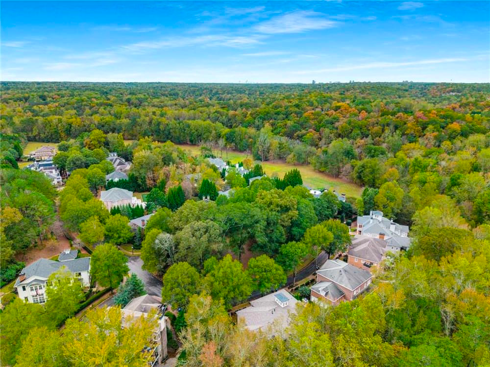
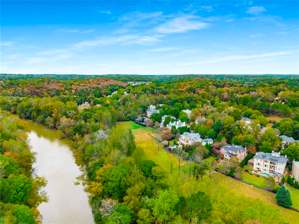
Ellard’s architectural character draws inspiration from the classic American neighborhoods of the past yet the land itself carries a much deeper story shaped by the Chattahoochee River and the crossings that once defined this region.
For thousands of years, the river corridor has influenced movement, settlement, and commerce. Archaeological surveys indicate human habitation and use of local river crossings dating back 8,000 to 10,000 years. The name “Chattahoochee” is derived from the Creek language, often interpreted as “marked stone,” referencing distinctive rock formations along the river.
Native American Presence & Early Georgia
The area was originally occupied by the Creek Nation. In the mid-18th century, control of lands north of the Chattahoochee shifted to the Cherokee following conflict between the tribes. By the early 1800s, pressures from westward expansion led to a series of land cessions to the State of Georgia.
Following the discovery of gold in northwest Georgia in 1831, the Georgia Legislature commissioned surveys of Cherokee-held territory to divide and distribute land through state lotteries. Though removal would take several more years, these actions marked the beginning of the forced displacement of the Cherokee people.
In 1838, 39, the U.S. Army carried out the removal of the Cherokee from Georgia to Indian Territory (present-day Oklahoma). The forced migration became known as the Trail of Tears, during which thousands perished. The lands surrounding present-day Ellard were part of this broader and painful chapter in Georgia’s history.
River Crossings & Early Transportation
As settlement expanded into the Alabama Territory, reliable river crossings became essential. In 1827, the Georgia General Assembly approved the establishment of a ferry across the Chattahoochee at what was then known as Gates’ Ferry. The crossing was located just downstream from today’s Holcomb Bridge Road.
In 1834, Robert McAfee acquired the ferry rights and was granted permission to construct a covered bridge. McAfee’s Bridge stood approximately 220 feet long and became a critical transportation link along what was then called the Alabama Road, a major route for settlers traveling west.
One of the original stone support piers from McAfee’s Bridge remains visible in the river today.
Following the Civil War, the ferry resumed operation under Addison Holcombe, whose name later became associated with Holcomb Bridge Road (the spelling evolved over time). Over the decades, wooden structures gave way to a steel truss bridge in the early 1900s, which was eventually replaced with the modern bridge structure in the late 20th century.
The Civil War Era
By 1863, the Civil War had reached North Georgia. After Union forces captured Vicksburg, attention shifted toward Atlanta. In July 1864, Union cavalry under Brigadier General Kenner Garrard moved toward Roswell, seeking to secure key river crossings.
Confederate forces attempted to destroy bridges by filling them with cotton bales and setting them ablaze. Despite these efforts, McAfee’s Bridge was captured intact after intense fighting near Shallow Ford and the surrounding crossings. Union General William T. Sherman later moved troops through the Roswell area, rebuilding damaged bridges before eventually ordering them destroyed as military priorities shifted.
The river crossings near Ellard were thus tied directly to troop movements and military strategy during one of the defining conflicts in American history.
The Ellard & Garrard Legacy
In the early 1900s, approximately 1,200 acres of land in this area were acquired by Thomas Horace Ellard. Following his death, portions of the land were farmed and stewarded by his family, including connections to Laurence C. Garrard and Leila Belle Ellard Garrard.
For decades, the Garrard family resisted development, preserving the land’s rural character and river frontage. According to family accounts, when approached about selling the land for development, they declined, stating their desire not to see it “paved and covered with concrete and asphalt.”
Eventually, estate circumstances and regional growth led to portions of the property being sold. In 1998, Ellard Village was established. In 2006, additional acreage west of the river was acquired for public use, contributing to what is now Garrard Landing Park, preserving river access for the broader community.
Today, Conservatory Park within Ellard honors Lawrence and Leila Ellard Garrard, whose stewardship helped shape the preservation of this land.
A Continuing Story
The history of this area extends far beyond a single summary. From Native American settlement to ferry crossings, from Civil War troop movements to generational land stewardship, the land that is now Ellard has witnessed centuries of transformation.
Ellard’s development sought to respect that legacy, creating a neighborhood that feels rooted, enduring, and connected to both its architectural traditions and its natural surroundings.
For those interested in deeper historical study, valuable resources include:
Publications by Michael D. Hitt
The Roswell Historical Society